Cartography
Iceland : Land of Fire and Ice
An exercise in merging and clipping digital elevation models (GTOPO30), as well as working with Digital Chart of the World datasets. Glacier and lava fields use transparencies to show the underlying terrain, and the elevation scale includes hillshading-like texture to give a more realistic comparison.
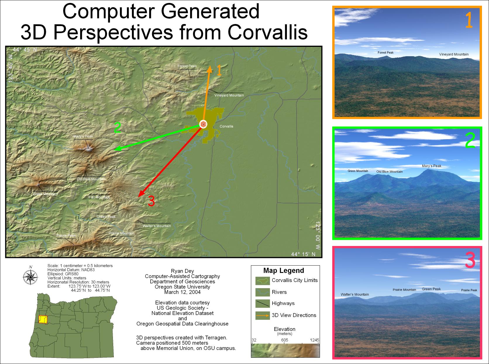
Computer-Generated 3D Perspectives from Corvallis Oregon
Produced as a 24x18 poster, this was the first time I used 3D perspective views to give the map viewer a more realistic idea of how the terrain on a map looks in the real-world. The perspectives were created in Terragen using NED elevation data and procedural ground cover.
Digital Photography Gallery with Spatial Organization
An exploration of ways to combine maps with other forms of media, this photo gallery allows access to my photography based on where the photos were taken rather than chronological or thematic organization commonly used.
Computer-Generated 3D Perspectives from Corvallis Oregon (Animated)
A screen capture from another online Flash-based project, this map positions a virtual camera 500 feet above Corvallis and allows the user to spin the 3D perspective as if they actually there. The real challenge was to present the imagery in small file size that would work over the Internet.
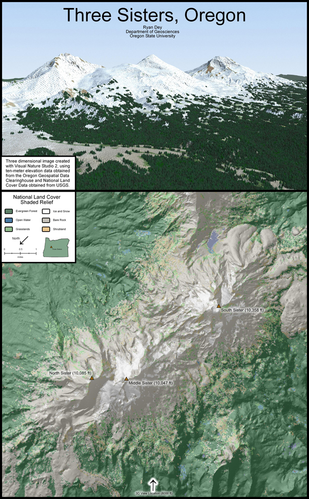
Three Sisters, Oregon
Produced as a large poster, this map is another combination of two-dimensional and three-dimensional visualization techniques. Produced from the same 10- meter DEM and 30-meter land cover datasets, Visual Nature Studio was used to create the 3D render and ArcGIS was used for the 2D map.
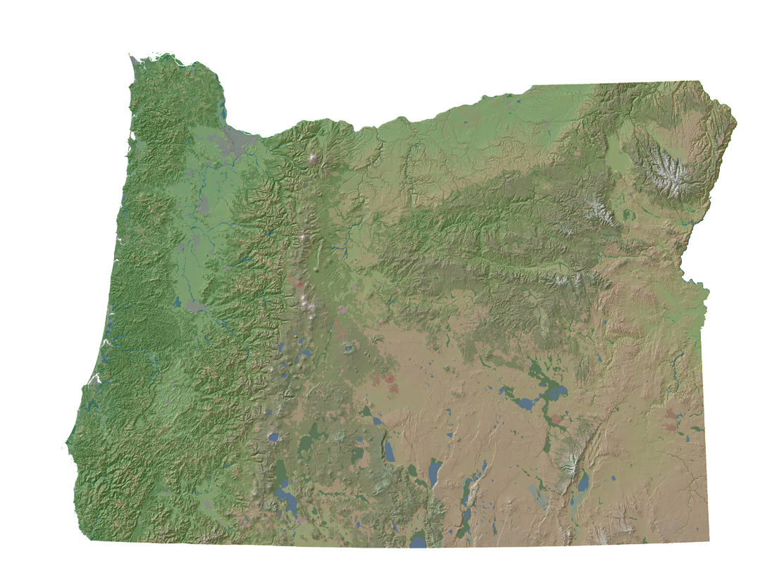
Oregon 10-meter Elevation and 30m GAP Vegetation Cover
Produced as a Gee Whiz project, this map combines 10-meter elevation data with 30-meter GAP vegetation cover data to give a natural view of Oregon . The 10-meter elevation data was merged into a single high-resolution raster dataset that covers the entire state of Oregon , and is several gigabytes in size. This map has sufficient resolution to produce posters up to about 10 feet wide with no loss in detail.
Oregon 10-meter Elevation and 30m GAP Vegetation Cover (Full resolution subset) - Coming soon!
A small subset of the previous map, this image is zoomed into the Mt. Hood area to showcase the high-resolution nature of these datasets. The detail seen in this image is consistent throughout the entire state of Oregon .
GIS and Data Analysis
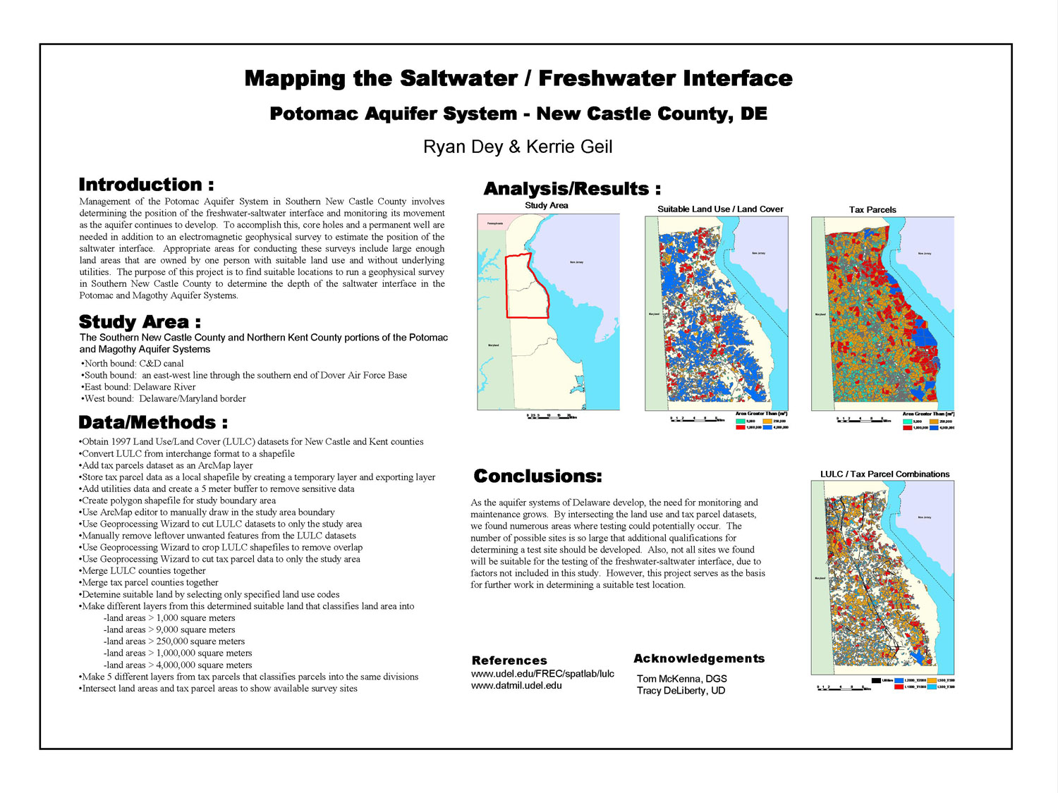
Mapping the Saltwater / Freshwater Interface
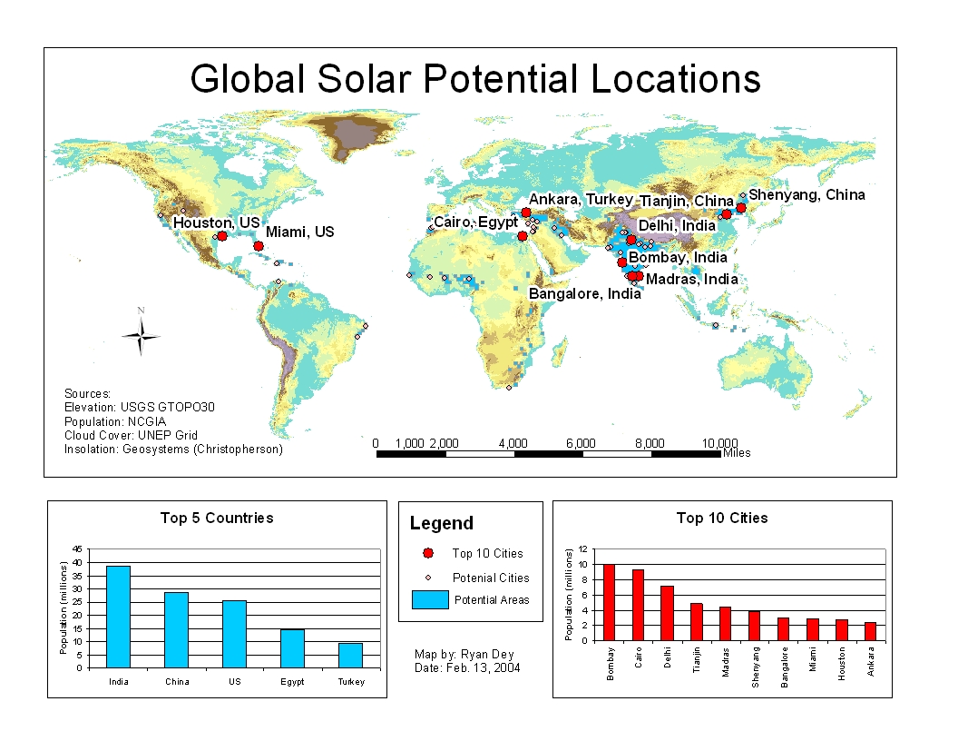
Global Solar Potential Locations
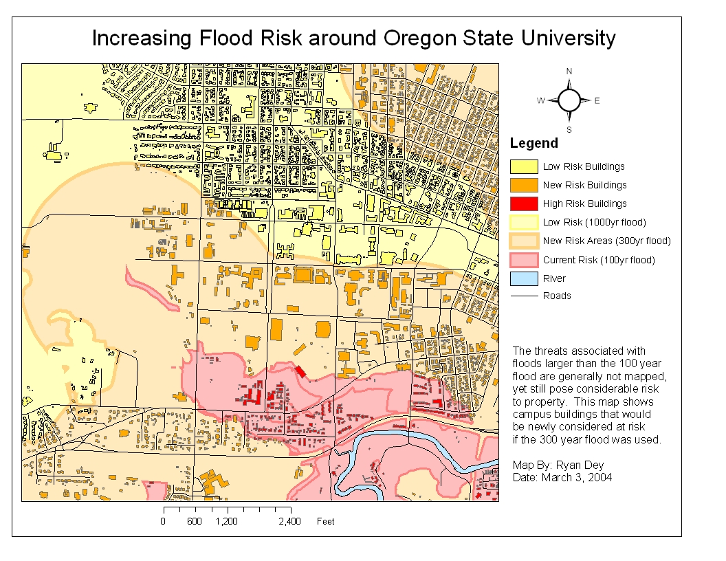
Increasing Flood Risk around Oregon State University
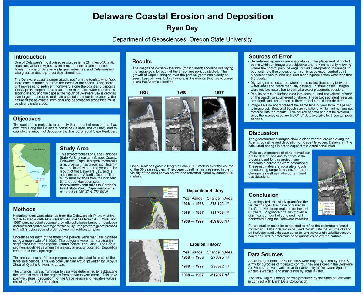
Delaware Coastal Erosion and Deposition
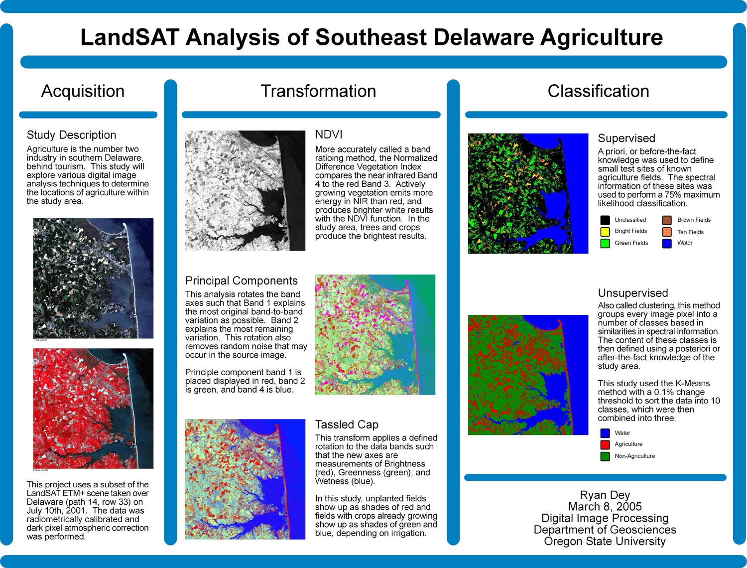
LandSAT Analysis of Southeast Delaware Agriculture
Corvallis Area Land Use - Coming Soon!
Mt Hood, Oregon Surface Analysis - Coming Soon!
Geo 560 - Multimedia Cartography
Spring 2004
All Maps on this page are © Ryan Dey, Department of Geosciences, Oregon State University